
Can Satellites See at Night? Optical, Thermal and Radar
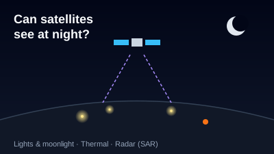
Quick Answer: Some can, depending on the sensor. An ordinary optical camera, like Sentinel-2's, measures reflected sunlight, and Sentinel-2 crosses the equator at 10:30 a.m. local time, so it records nothing useful at night. A low-light sensor such as the VIIRS Day/Night Band records light emitted at night (cities, fires, gas flares, boats) and, by moonlight, clouds and snow. Thermal infrared measures heat, so NASA FIRMS active fire data and MODIS land surface temperature include nighttime observations. Synthetic aperture radar (SAR) sends its own microwave pulses, so Sentinel-1 and commercial radar satellites image in darkness and through cloud.
Yes, some satellites can see at night, but not with an ordinary camera. What a satellite sees after dark depends on where the energy it measures comes from: reflected sunlight (nothing at night), light emitted on the ground (city lights, fires, moonlit clouds), heat emitted by every surface (thermal infrared), or microwave pulses the satellite sends itself (radar). Each of these is covered below, with the public missions that use it.
Why can't an ordinary satellite camera see at night?
An ordinary satellite camera is a passive optical sensor: it records sunlight reflected by the ground, so with no sunlight there is nothing to record. Optical Earth-observation missions are also put in orbits that pass in daylight. Sentinel-2 flies a sun-synchronous orbit at a 786 km mean altitude, crossing the equator at 10:30 a.m. mean local solar time on its descending node (SentiWiki: Sentinel-2 mission).
A sun-synchronous orbit keeps that local time fixed, so every Sentinel-2 image of a given place is taken in the same mid-morning light. The other half of each orbit crosses the night side of the planet, where a visible and near-infrared camera has almost nothing to measure. This is why free optical archives contain essentially no night scenes. For the general picture of how such sensors build an image line by line, see How Satellites Capture Images, and for why the morning orbit is chosen, Satellite Orbit Types Explained.
Which kinds of satellite sensors work at night?
Three kinds of sensor work in darkness, each for a different physical reason. A low-light visible sensor measures light emitted on the ground. A thermal infrared sensor measures heat that every surface radiates day and night. A radar sends its own microwave pulses and measures the echo. NASA describes SAR as an active sensor that "enables high resolution imagery to be created night or day, regardless of weather conditions" (NASA Earthdata: SAR).
| Sensor type | Works at night? | What it sees in the dark | Example mission |
|---|---|---|---|
| Ordinary optical (visible, near-infrared) | No | Nothing useful; it needs reflected sunlight | Sentinel-2, 10:30 a.m. descending node (SentiWiki) |
| Low-light visible | Yes, for light sources; surfaces only under moonlight | City lights, fires, gas flares, fishing boat lights, moonlit clouds and snow | VIIRS Day/Night Band on Suomi NPP, NOAA-20, NOAA-21 (NASA Black Marble) |
| Thermal infrared | Yes | Emitted heat: active fires, surface temperature | VIIRS 375 m and MODIS active fires in NASA FIRMS; MODIS MOD11A1 night LST (NASA Earthdata) |
| Synthetic aperture radar (SAR) | Yes, and through cloud | Echo of its own microwave pulses: structures, surface roughness, water | Sentinel-1 (SentiWiki); commercial ICEYE and Capella |
The rest of this article takes each row in turn.
What does the VIIRS Day/Night Band see at night?
The VIIRS Day/Night Band (DNB) is a low-light visible sensor that records light emitted on Earth at night. NASA describes it as "a specialized sensor with variable gain settings designed to capture low-light imagery of Earth at night", with a spatial resolution of 750 m, and lists the light sources it picks up: "city lights, lightning, fishing fleet navigation lights, gas flares, lava flows, and even auroras" (NASA Black Marble).
VIIRS flies on three satellites: Suomi NPP (launched October 2011), NOAA-20 (November 2017) and NOAA-21 (November 2022), per the same NASA page. Each one observes the day side on the ascending node and the night side on the descending node; Suomi NPP crosses the equator northbound at about 13:30 local time, so its night pass is around 1:30 a.m., and the three satellites observe within about an hour of one another (NASA Earthdata: VIIRS 375 m active fire).
Suomi NPP is about to drop out of that set. NOAA's notice states that S-NPP VIIRS "data will no longer be available after November 2, 2026, at 13:00 UTC" and tells users to move to NOAA-21 (primary) and NOAA-20 (secondary) (NOAA NESDIS).
Can satellites see clouds at night?
Yes, in two ways. The VIIRS Day/Night Band sees clouds when the Moon lights them: on a full-moon night in January 2021, NOAA-20's DNB showed "moonlight-enhanced snow on the ground" across the Plains and Midwest and "high wispy cirrus clouds" over the Great Lakes "reflecting the moonlight back to the satellite's sensor" (NOAA NESDIS, 29 January 2021). Thermal infrared sees clouds by their temperature, with or without moonlight.
Moonlight is also why nighttime-light measurements need correcting before they can be compared across nights. The daily NASA Black Marble product built from NOAA-20, VJ146A2, is described as "a daily moonlight- and atmosphere-corrected Nighttime Lights (NTL) product" on a 15 arc-second grid, with a record from 2018-01-19 (NASA Earthdata: VJ146A2). For what those lights can and cannot tell you about cities, see What Nighttime Lights Tell Us About Cities; for tracking them over months, VIIRS Nighttime Light Time Series.
Can satellites see Earth at night, and where do the "Earth at night" images come from?
The well-known images of Earth at night, with continents outlined by city lights, are composites of VIIRS Day/Night Band observations. NASA's Black Marble project turns DNB data into products (VNP46, VJ146 and VJ246) that "provide a long-term record of global nighttime light composites" (NASA Black Marble). They are composites built from many nights of observation, not a single photograph.
A single night is less tidy than the composite. Clouds hide the lights below them, moonlight brightens the surface, and the 750 m DNB pixel blurs individual streets. The Off-Nadir Delta nighttime lights map shows the daily Black Marble product (VJ146A2 from NOAA-20, with the Suomi NPP archive for dates before 2019-08-28); the VIIRS layer is included on the plans listed in Pricing.
How do satellites detect fires at night?
Fires are detected in thermal infrared, which measures emitted heat and therefore works day and night. NASA FIRMS distributes VIIRS 375 m and MODIS 1 km active fire detections, with global data "available within 3 hours of satellite observation" (NASA FIRMS). NASA notes that the 375 m VIIRS product "has improved nighttime performance", and every detection carries a DayNight field marked D or N.
How a detection gets its N flag depends on the processing. The FIRMS FAQ explains that near-real-time data flag day or night by ascending versus descending pass, while standard processing assigns night when the solar zenith angle exceeds 85 degrees. Revisit is several looks a day: "at least four daily MODIS observations for almost every area on the equator", and 3–4 VIIRS looks a day at mid-latitudes, per the same FAQ.
Night detections are not limited to wildfires. FIRMS separates out static thermal anomalies, which "can include petrochemical and cement production, gas flares and volcanoes" (FIRMS FAQ). The live active fire map shows the FIRMS VIIRS and MODIS layers, day and night passes combined, for any date, without an account. For a walkthrough, see NASA FIRMS Active Fire Monitoring.
Can thermal satellites measure temperature at night?
Yes. Thermal infrared sensors measure the radiation that surfaces emit according to their temperature, and that emission continues after dark. NASA's MODIS land surface temperature product MOD11A1 is a 1 km daily product "provided along with the daytime and nighttime surface temperature bands" (NASA Earthdata: MOD11A1).
Night values answer a different question from day values. Without the Sun heating the surface, the night image shows how materials hold and release heat, and weak signals such as geothermal warming are not masked by solar heating. The physics, the main missions and their limits are covered in Land Surface Temperature: Thermal Remote Sensing.
Thermal sensors have a cost: the pixels are coarse. MODIS LST is 1 km and VIIRS active fire 375 m, so a night thermal image tells you something is hot, not what the building looks like.
How does radar (SAR) see in the dark?
Synthetic aperture radar (SAR) sees in the dark because it supplies its own illumination. It transmits microwave pulses and records the echo, so the Sun plays no part. Sentinel-1 carries a C-band SAR at 5.405 GHz (about 5.55 cm wavelength) that, per ESA, operates "day and night" and can "acquire imagery regardless of the weather" (SentiWiki: Sentinel-1 mission).
Sentinel-1's orbit shows the point. It is sun-synchronous at 693 km with the ascending node at 18:00 local time, so its passes fall near dusk and dawn, and in many seasons and latitudes those passes are in darkness. A radar image from such a pass looks the same as one taken at noon. The same centimetre-scale wavelength is why clouds do not block it; the physics is in Why SAR Can See Through Clouds.
The current constellation has changed this year. ESA confirmed that "Sentinel-1A's operational duties ended on 29 June 2026", with the mission continuing on Sentinel-1C and Sentinel-1D (ESA). Sentinel-1 imagery is included in the Off-Nadir Delta free plan; see the Sentinel-1 SAR viewer.
Can spy satellites or military satellites see at night?
Public sources can only answer this for commercial systems. Commercial radar operators state it directly: ICEYE says its satellites can "monitor any location on Earth, day and night, in any weather" (ICEYE), and Capella says its "SAR sensors penetrate clouds, fog, darkness, and smoke", at "sub-0.25 m resolution" (Capella Space). These are vendor statements about their own products.
The capabilities of classified government reconnaissance satellites are not published, and this article does not guess at them. What can be said is that every satellite, whoever owns it, is bound by the same physics: in darkness a sensor can only measure light emitted on the ground, heat, or the echo of energy it sends itself. A daylight camera at any resolution sees nothing useful on a moonless night.
For what openly available imagery shows of conflict areas, and where it stops, see What Free Satellite Imagery Shows of War. For how free and commercial sources compare in general, see Free vs Commercial Satellite Imagery.
Which sensor should you use to look at a place at night?
Choose by the question. To see whether lights are on (an outage, a new settlement, boats offshore), use the VIIRS Day/Night Band. To see whether something is burning or hot, use thermal infrared through FIRMS. To see structures, water or ships in darkness or under cloud, use SAR such as Sentinel-1. A daytime optical image from the next clear morning is still the most readable picture of what the place looks like.
These sensors are often combined. A night fire detection gives the time and place, a SAR pass the next evening shows the ground through smoke, and the next clear Sentinel-2 morning shows the burn scar in colour; How to Confirm and Date a Fire with Satellite Data walks through the fire case, and SAR vs Optical: When to Use Which covers the broader trade-off. Terms such as VIIRS and thermal anomaly are defined in the glossary.
Written by Kazushi Motomura. Sources were opened on 2026-10-29; mission status and data availability change, so check the linked pages for current dates.

Remote sensing specialist with 10+ years in satellite data processing and AI. Founder of Off-Nadir Lab. Ph.D. in Informatics (Yokohama National University, 2026). Master's in Earth System Science and Technology (Kyushu University). Co-author, Remote Sensing Encyclopedia. More about the author →