
Can Satellites See People, Faces or License Plates?
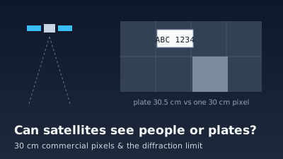
Quick Answer: Satellites can detect a person as a dot or a shadow in the sharpest commercial imagery, but they cannot recognise a face or read a license plate. The finest commercial satellite pixels published by vendors are about 30 cm (WorldView-3 is 31 cm at nadir, Pléiades Neo 30 cm); 15 cm basemaps are made by processing 30 cm imagery. A US license plate is 12 × 6 inches with characters 1 inch wide, and it faces sideways, not up. Reading those characters from about 600 km would need a telescope tens of metres across. Free imagery is far coarser: Sentinel-2 is 10 m and Landsat 30 m, where a person or a car is smaller than one pixel. Optical satellites record surfaces and radar echoes off roofs and walls, so neither sees inside a house. Classified reconnaissance capabilities are not public.
Satellites can see that a person is there only in the sharpest commercial imagery, and then as a dot a pixel or two across, often picked out by its shadow. They cannot show a face, and no published satellite image can read a license plate. The limit is not secrecy or software. It is the size of a pixel on the ground, set by the telescope's diameter, the orbit's height and the air in between. The numbers below come from vendors, space agencies and a state motor vehicle department.
Can satellites see people from space?
Commercial satellites with roughly 30 cm pixels can show a person as a small blob, recognisable mostly from context and from the shadow it casts, not as a body with features. A person seen from directly above is a head and shoulders well under a metre across, which at 30 cm is a few pixels. Free satellites with 10 m pixels, such as Sentinel-2, cannot show individual people at all.
What a 30 cm image does show is crowds, queues, vehicles and the shapes of things larger than a few pixels. What it does not show is who anyone is. A face is a few centimetres of detail turned towards the horizon, not the sky, so it is both too small and pointing the wrong way. For a target-by-target guide to free 10 m imagery, see What Can You Actually See in 10 m Satellite Imagery?.
How sharp is the best commercial satellite imagery?
The sharpest commercial satellite imagery that vendors publish has a pixel of about 30 cm on the ground. WorldView-3 records 0.31 m panchromatic at nadir and 0.34 m at 20° off-nadir, Pléiades Neo 30 cm panchromatic, and Vantor sells 30 cm imagery from its WorldView constellation. Colour (multispectral) bands are coarser, about 1.2 m, and are commonly sharpened using the panchromatic band.
The figure that sizes everything is the ground sample distance (GSD), the distance on the ground between the centres of neighbouring pixels; see spatial resolution in the glossary.
| Satellite or product | Finest pixel on the ground | Source |
|---|---|---|
| WorldView-3 (launched 13 August 2014, 617 km) | 0.31 m panchromatic at nadir, 0.34 m at 20° off-nadir; 1.24 m multispectral | ESA Earth Online: WorldView-3 |
| Pléiades Neo 3 and 4 (620 km) | 30 cm panchromatic, 1.2 m multispectral, 14 km swath | ESA Earth Online: Pléiades Neo |
| Vantor WorldView constellation (10 satellites, including WorldView Legion) | "30 cm resolution", "over 3.5 million sq km at 30 cm" of daily capacity | Vantor: constellation, Vantor: WorldView 2D |
| Vantor Vivid Mosaic basemap | 15 cm in selected areas, made because "our HD processing upscales 30 cm imagery to 15 cm clarity" | Vantor: Vivid Mosaic |
| Sentinel-2 (free) | 10 m in four bands (blue, green, red, near-infrared) | SentiWiki: Sentinel-2 mission |
| Landsat 9 (free) | 30 m, 15 m panchromatic | USGS: Landsat 9 |
The 15 cm row needs reading carefully. Vantor states that the 15 cm basemap comes from processing 30 cm imagery, so it is a sharper-looking picture of the same measurement, not a camera with 15 cm pixels. Processing can make edges cleaner; it cannot recover a licence-plate character that the 30 cm pixel never recorded. The same caution applies to colour imagery sharpened with a panchromatic band, explained in Pansharpening: Resolution Enhancement.
Can satellites read license plates?
No. A US passenger license plate is 12 inches wide and 6 inches high (30.5 × 15.2 cm), with characters 1 inch wide and 2.5625 inches high separated by 0.375 inches, according to the Texas Department of Motor Vehicles specification, which follows the AAMVA best-practices model. One 30 cm commercial pixel is about the width of the whole plate, so each character is a small fraction of a pixel.
| Object | Real size | Source | Size in 30 cm pixels | Size in 10 m Sentinel-2 pixels |
|---|---|---|---|---|
| US passenger license plate | 12 × 6 in (30.5 × 15.2 cm) | TxDMV License Plate Specifications | About 1 × 0.5 | About 0.03 × 0.015 |
| One plate character | 1.0 × 2.5625 in (2.5 × 6.5 cm) | Same document | About 0.08 × 0.2 | About 0.003 × 0.007 |
| Gap between characters | 0.375 in (0.95 cm) | Same document | About 0.03 | About 0.001 |
Geometry makes it worse. A plate is mounted on the front or back of a vehicle and faces horizontally, so a satellite looking straight down sees its top edge. Tilting the view to see the face of the plate lengthens the line of sight and coarsens the pixel: WorldView-3 goes from 0.31 m at nadir to 0.34 m at 20° off-nadir (ESA Earth Online). The broader trade-offs of tilted views are in What Is Off-Nadir Satellite Imagery?.
Why can't a satellite just zoom in further?
A telescope cannot resolve detail finer than its diffraction limit. The Rayleigh criterion gives the smallest resolvable angle as θ = 1.22λ/D, where λ is the wavelength of the light and D the diameter of the lens or mirror (OpenStax University Physics, Vol. 3, §4.5). From orbit, finer ground detail needs a proportionally wider mirror.
Multiplying that angle by the distance to the ground gives the smallest detail a perfect telescope could separate. The table works it out for green light (550 nm) from 617 km, the altitude of WorldView-3. It is the best case: real images also lose sharpness to the detector, the satellite's motion and the atmosphere.
| Detail to resolve from 617 km | Mirror diameter needed (θ = 1.22λ/D, λ = 550 nm) | What that detail corresponds to |
|---|---|---|
| 31 cm | About 1.3 m | WorldView-3's published nadir pixel (ESA) |
| 10 cm | About 4.1 m | Three times finer than any commercial pixel in the table above |
| 2.5 cm | About 17 m | Width of one plate character (TxDMV) |
| 1 cm | About 41 m | Roughly the gap between plate characters, the detail needed to read them |
For scale, OpenStax gives the Hubble Space Telescope's primary mirror as 2.40 m. A Hubble-sized mirror at 617 km would, by the same formula, separate details of about 17 cm at best. Reading a plate would take a mirror more than ten times that size.
The atmosphere adds a second limit. Light from the ground crosses the full depth of the air before it reaches the satellite, and haze and turbulence lower contrast and blur fine detail, more so on a tilted view with a longer path. A satellite also has only one chance per pass, at whatever angle the orbit allows.
How close can spy satellites see?
What classified reconnaissance satellites can resolve today is not public, and this article does not estimate it. The public record is declassified film imagery held by the USGS. The KH-7 surveillance system, operated from July 1963 to June 1967 and declassified in 2002, had a ground resolution of 2 to 4 feet (about 0.6 to 1.2 m) (USGS EROS: Declassified Data 2).
The earlier CORONA programme, declassified by Executive Order 12951 in 1995, reached a best ground resolution of 6 feet with the KH-4B camera between 1967 and 1972 (USGS EROS: Declassified Data 1). Those figures describe systems retired more than half a century ago, and they say nothing about current ones.
What can be said is that any satellite, whoever owns it, works under the same Rayleigh limit and looks through the same atmosphere. Reading centimetre-scale detail from hundreds of kilometres up would, by the Rayleigh formula, need a mirror many times wider than Hubble's 2.40 m. No public source cited here documents a face or a plate read from orbit.
Is high-resolution commercial satellite imagery regulated?
In the United States, yes. Private operators of remote sensing satellites need a licence from the Commerce Department. Its Office of Commercial Remote Sensing Regulatory Affairs (CRSRA) licenses "private operators of remote sensing space systems", issues those licences under 15 C.F.R. Part 960 and the National and Commercial Space Programs Act (51 U.S.C. § 60101 et seq.), and monitors compliance (NOAA Office of Space Commerce: CRSRA).
The CRSRA page does not state resolution limits, and this article does not add any. Licence conditions for a particular system are set in that system's licence. The finest pixels that vendors advertise on their own pages are those in the table above.
Can satellites see inside your house?
No. An optical satellite records sunlight reflected from the outside of things, so it sees roofs, yards and anything visible through an open space, not rooms under a roof. Radar does not change this. NASA notes that buildings produce "double bounce scattering", a strong echo from walls and ground, and that radar penetration depends on wavelength, into forest canopy, dry soil or sand (NASA Earthdata: SAR).
A radar image of a town is therefore bright where walls and streets form corners and dark where flat surfaces reflect the pulse away. It shows the outside geometry of a building, and it does so at metres, not centimetres: Sentinel-1's main land mode records "5 m by 20 m spatial resolution (single look)" (SentiWiki: Sentinel-1 mission). For why radar passes through clouds but still reflects off solid surfaces, see Why SAR Can See Through Clouds. At night, sensors record lights and heat, not interiors; see Can Satellites See at Night?.
Why do map apps show cars and people, then?
Many of the sharpest pictures in map apps are not from satellites. Google states that Earth imagery is "taken by cameras on satellites and aircraft", that images are collected over time and that "Images aren't in real time, so you won't see live changes" (Google Earth Help). An aircraft flying a few kilometres up is far closer than a satellite hundreds of kilometres up, so the same diffraction limit allows much finer detail.
Even then, the result is a dated mosaic. A car visible in a map app was parked there on the day that tile was captured, which may be months or years ago. The myth that satellites read plates is addressed briefly in What Is Remote Sensing?; this article supplies the numbers behind that answer.
What can free satellite imagery show of people and cars?
Free imagery cannot show individual people or cars. Sentinel-2 has four 10 m bands, so a pixel covers 100 square metres, and Landsat 9 has 30 m multispectral and 15 m panchromatic pixels. A car or a person is a small fraction of one pixel. What free imagery shows is the footprint of activity: cleared ground, new buildings, a full car park as a change in colour, a ship.
Off-Nadir Delta serves this free systematic imagery, mainly Sentinel-1 radar and Sentinel-2 optical, and both are included in the free plan. It does not sell sub-metre commercial imagery and it cannot order a satellite to photograph a place. Its satellite pass prediction works out when free systematic satellites (Sentinel-1, Sentinel-2, Landsat, NISAR) and taskable commercial ones next pass over a place; a commercial pass is an opportunity to buy, not an image. For how free and paid sources differ, see Free vs Commercial Satellite Imagery, and for the other three kinds of resolution, 4 Types of Resolution in Remote Sensing.
To judge it for yourself, open the Sentinel-2 viewer over a place you know and count how many 10 m pixels a familiar building covers. Terms such as GSD, off-nadir angle and SAR are defined in the glossary.
Written by Kazushi Motomura. Sources were opened on 2026-10-29. Satellite constellations and vendor products change, so check the linked pages for current figures.

Remote sensing specialist with 10+ years in satellite data processing and AI. Founder of Off-Nadir Lab. Ph.D. in Informatics (Yokohama National University, 2026). Master's in Earth System Science and Technology (Kyushu University). Co-author, Remote Sensing Encyclopedia. More about the author →