
Geospatial Intelligence Platforms Compared (2026)
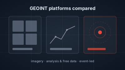
Quick Answer: Geospatial intelligence platforms fall into three groups. Commercial imagery companies (Vantor, Planet, BlackSky, Airbus OneAtlas) sell their own satellite collection, from 15 cm basemaps to tasking returned in near real time, plus analytics; prices are quoted on request or behind a pricing page. Analysis software and free data (Esri ArcGIS, Google Earth Engine, QGIS, Copernicus Browser) leave the collection or the analysis to you. Off-Nadir Delta starts from geolocated events, says how precisely each is placed and follows up with free Sentinel imagery, but it sells no commercial imagery and cannot task a satellite.
The right geospatial intelligence platform depends on which part of the work you are missing. If you need sharper pixels or a satellite pointed at a place on demand, you are buying from an imagery company: Vantor, Planet, BlackSky or Airbus. If you already have data and need to analyse it, the options are software such as Esri ArcGIS, QGIS or Google Earth Engine. If you need to know where to look first, an event-led tool such as Off-Nadir Delta fits.
US law defines geospatial intelligence as "the exploitation and analysis of imagery and geospatial information to describe, assess, and visually depict physical features and geographically referenced activities on or about the earth" (10 U.S.C. § 467). Every platform below covers part of that definition. None covers all of it alone.
This article describes each platform only from its own official pages, opened on 2026-10-29. It does not rank them and it does not repeat customer counts. Off-Nadir Delta is included because it is the product this site publishes; its section states what it does not do as plainly as what it does.
What should you compare when choosing a GEOINT platform?
Compare four things: where the imagery comes from, whether you can order new collection, what analysis the platform does for you, and how you get access. A platform that owns satellites can task them and sell sub-metre pixels. A software platform analyses data you bring. A free data portal gives you open imagery but no interpretation. Pricing transparency varies widely, and most commercial vendors quote on request.
Two more questions narrow the list quickly:
- Do you know where to look already? Imagery platforms assume you bring the area of interest. An event-led tool proposes it.
- Do you need to publish or share the result? Licence terms differ. Copernicus Sentinel data is released under a free and open data policy; commercial imagery comes with the vendor's licence.
Which companies sell commercial satellite imagery with analytics?
Four companies combine their own satellite constellations with an analysis platform. All four are built around commercial collection you pay for, and none of their homepages lists a price.
| Platform | How it describes itself (official page) | Imagery stated on the page | Access |
|---|---|---|---|
| Vantor | "Spatial intelligence for a more autonomous, interoperable world" | WorldView tasking; Vivid Mosaic "15 cm and 30 cm global basemaps"; WorldView Radar with SAR from Umbra | "Get in Touch" / "Contact Us" |
| Planet | Planet Insights Platform: "the central place where daily Earth data, analytics, and powerful tools are combined" | PlanetScope 3 m; SkySat "50 cm precision, sub-daily revisit"; hyperspectral for methane | Has a pricing page; no figures repeated here |
| BlackSky | "Real-time, AI-enhanced tactical ISR built for defense, intelligence and global security leaders" | "up to 15 time-diverse images" of a location across the day; no resolution figure on the homepage | On-Demand and Assured tasking; "Schedule a conversation" |
| Airbus OneAtlas | "OneAtlas provides access to optical and radar imagery through our archive, tasking, elevation models and more" | Pléiades Neo 30 cm; Pléiades 50 cm; SPOT 1.5 m; radar archive "from 25 cm to 40 m resolution" | Pay-per-order, the Living Library subscription, and guest access that "does not provide full resolution" |
How do the commercial imagery platforms differ?
They differ in what they emphasise. Vantor's homepage leads with high-resolution basemaps and a set of named platform products (Tensorglobe, Cortex, Forge, Nexus and The Vantor Hub); its about page says its constellation can "revisit the same location on Earth up to 15x per day". The old maxar.com address now redirects to vantor.com, and the WorldView and Vivid product names continue there. Planet emphasises frequency: daily medium-resolution coverage plus 50 cm SkySat. BlackSky sells speed for defence users, with tasking "in minutes" and automatic analysis. Airbus is the most explicit about ordering models, with archive, tasking and subscription each listed separately.
Vantor also runs an Open Data Program that releases before-and-after imagery of major sudden-onset disasters under a Creative Commons BY-NC 4.0 licence. That is the one route on these pages to commercial pixels at no cost, and it covers only the disasters Vantor activates it for.
Which GEOINT tools are free or open source?
The free options are software and data, not a finished intelligence service. They are capable, but you choose the place, the dates and the method, and you interpret the result yourself.
| Tool | What it is (official page) | Cost and licence | What you still do yourself |
|---|---|---|---|
| Copernicus Browser | Viewer for the Copernicus Data Space Ecosystem: Sentinel-1, Sentinel-2, Sentinel-3, Sentinel-5P and elevation models, with compare, timelapse and download | "Currently you need a free account to use the Browser"; Copernicus has a "free and open data policy" (dataspace.copernicus.eu) | Decide where and when to look; read the image |
| Google Earth Engine | "A planetary-scale platform for Earth science data & analysis" with "over eighty petabytes of geospatial data" | "available for commercial use, and remains free for academic and research use"; no prices on the homepage | Write the analysis code |
| QGIS | Desktop GIS: "Spatial visualization and decision-making tools for everyone", on Windows, Mac and Linux | "Free and Open Source", licensed under GNU GPLv2+ | Bring the data; build the workflow |
What does free GEOINT software ask of you?
It asks you to supply the question. Copernicus Browser shows you a 10 m Sentinel-2 scene of any place, but it does not tell you which place matters this week. Google Earth Engine can run an analysis over decades of imagery, but someone has to write it. QGIS is a full desktop GIS with no imagery of its own. The trade-off is control: you decide the method and can document it. For the difference between working in a browser and on the desktop, see Browser-Based WebGIS vs Desktop GIS.
Where does Esri ArcGIS fit for defense and intelligence?
Esri ArcGIS is analysis and mapping software, not a satellite operator. Esri's defense page presents it as "ArcGIS—A complete system for the entire force" and says it "is cloud-ready and can be configured for denied, disconnected, intermittent, and low-bandwidth (DDIL) environments" (Esri defense). Pricing is through "Contact sales". In practice it sits alongside an imagery source rather than replacing one.
Where does Off-Nadir Delta fit?
Off-Nadir Delta starts from events rather than from pixels. The Watchfloor shows geolocated world events drawn from global news media and official hazard feeds, plus events made from satellite and instrument measurements, with reports of the same event folded into one. From an event you can open free Sentinel imagery of the place and ask Delta Agent, an AI analyst, what it means. It is built for open-data situational awareness.
What it does, as of 2026-10-29:
- A stated placement precision for every event. Each event sits on a three-step ladder: Reported (country or province), Localized (town or city) or Pinpointed (street block or facility). Only Localized and Pinpointed events are drawn as points.
- Measured events, not only reported ones. The record includes heat anomalies near registered facilities from NASA FIRMS, strait and canal transit counts that leave their usual level, and earthquakes near registered facilities from USGS. These are measurements, labelled as such.
- Free Sentinel imagery on a free account. Sentinel-1 radar and Sentinel-2 optical imagery are included in the free plan. VIIRS night lights, NISAR L-band radar and difference analysis are on paid plans.
- Ship detection and monitoring. Ship detection runs on Sentinel-1 GRD and NISAR GCOV scenes and returns a position for each detection, metered in tokens. A monitored area measures every new pass and flags a value that breaks from the place's own history; a free account can keep one.
- Collection planning. Delta can say when a place can next be imaged, by free systematic satellites (Sentinel-1/2, Landsat, NISAR) or by commercial satellites you could task, such as WorldView, ICEYE, Capella or SkySat (how pass prediction works).
- The same functions outside the app. A REST API, an MCP server for AI assistants and a Python SDK (
pip install offnadir-delta) are open to free accounts; see the API docs.
What does Off-Nadir Delta not do?
Off-Nadir Delta does not sell commercial imagery and cannot task a satellite. It tells you when a commercial satellite could see a place, but you buy the collection from the operator. Its imagery is Sentinel-class (about 10 m), so it will not identify a vehicle or an aircraft type (what 10 m can resolve). It does not ingest AIS, so a ship detection has a position but no name or flag. It does not do InSAR, so it cannot measure millimetre ground movement. On a free account, an event's summary, facts and source list are withheld; those are on paid plans.
Geospatial intelligence platforms compared: which one fits the job?
Pick by the job you are missing. If you need pixels, compare the imagery companies on resolution, revisit and licence. If you need analysis, compare the software. If you need to know where to look and what is already reported there, start from events.
| If you need to… | Look at |
|---|---|
| Buy sub-metre imagery or a global high-resolution basemap | Vantor, Airbus OneAtlas, Planet (SkySat) |
| See the same place every day at medium resolution | Planet |
| Task a satellite and get analysed imagery back fast | BlackSky, Vantor, Airbus OneAtlas |
| Run your own analysis over a large imagery archive in code | Google Earth Engine |
| Build maps and analysis on your own data, on the desktop | QGIS (free), Esri ArcGIS |
| Look at free Sentinel imagery of a place you already know | Copernicus Browser |
| Find out where something is happening, how precisely it is placed, and check it with free Sentinel imagery | Off-Nadir Delta |
Consider a hypothetical scenario: an analyst reads of a fire at a refinery. An event-led tool shows the event is Pinpointed to the facility, that a heat anomaly was measured there, and that a Sentinel-2 pass is due in two days. Whether a specific tank was hit is a sub-metre question; that is when commercial imagery from one of the vendors above earns its cost. The two kinds of platform answer different questions in sequence.
For the open-source side of the discipline, see What Is Geospatial OSINT? and the glossary. For when free imagery is enough and when it is not, see Free vs Commercial Satellite Imagery. The full open-data workflow is on the geospatial intelligence page.
Descriptions of third-party platforms are taken from their official pages as opened on 2026-10-29 and may change; check each vendor for current details. Off-Nadir Delta is an independent project by Off-Nadir Lab and is not affiliated with any platform named in this article.

Remote sensing specialist with 10+ years in satellite data processing and AI. Founder of Off-Nadir Lab. Ph.D. in Informatics (Yokohama National University, 2026). Master's in Earth System Science and Technology (Kyushu University). Co-author, Remote Sensing Encyclopedia. More about the author →