
What Is AIS Ship Tracking, and What If Ships Go Dark?
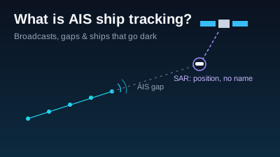
Quick Answer: AIS (Automatic Identification System) is a VHF radio system that ships use to broadcast who they are and where they are going. SOLAS regulation V/19 requires it on ships of 300 gross tonnage and upwards on international voyages, cargo ships of 500 GT and upwards on domestic voyages, and all passenger ships. A Class A unit sends position, course and speed every 2 to 10 seconds under way and name, IMO number, destination and draught every 6 minutes. Shore stations hear it to about 20 nautical miles; satellites pick it up over open ocean. Tracks have gaps for ordinary reasons (range, equipment, security switch-offs) and deliberate ones (disabling or spoofing). Radar satellites such as Sentinel-1 see ships whether or not they broadcast, but a radar detection has a position, not a name.
AIS ship tracking is the public face of a collision-avoidance radio. Every large ship carries an Automatic Identification System transponder that broadcasts its identity, position, course and speed on VHF several times a minute. Coastal receivers and satellites pick up those broadcasts, and websites that show ships on a map are plotting them. When a ship "goes dark", its broadcasts stop reaching anyone, for reasons that range from radio range to deliberate concealment.
This article explains the carriage rule, what an AIS message contains, how it is received, why the record has gaps, and how radar satellites find ships that are not broadcasting. Every rule and number below comes from an official or first-party page opened on 2026-10-29.
What is AIS ship tracking?
AIS is a ship-to-ship and ship-to-shore radio system standardised by the ITU and adopted by the International Maritime Organization (IMO). The US Coast Guard defines it as a system that "provides vessel information, including the vessel's identity, type, position, course, speed, navigational status and other safety-related information automatically to appropriately equipped shore stations, other ships, and aircraft" (USCG NAVCEN: AIS FAQ). Ship tracking is what happens when those broadcasts are collected and mapped.
The system was built to prevent collisions, not to publish fleets. The IMO describes its purpose as letting ships "receive automatically such information from similarly fitted ships", "monitor and track ships" and "exchange data with shore-based facilities" (IMO: AIS transponders). When the IMO Maritime Safety Committee discussed AIS data appearing on the web in December 2004, it said publication "could be detrimental" to the safety and security of ships, per the same IMO page. The public ship maps grew up anyway, from receivers anyone can install.
In shipping terms, "AIS data" usually means the decoded stream of these broadcasts, or an archive of them, sold or shared by whoever operates the receivers.
Which ships must carry AIS under SOLAS?
SOLAS regulation V/19 requires AIS on "all ships of 300 gross tonnage and upwards engaged on international voyages, cargo ships of 500 gross tonnage and upwards not engaged on international voyages and all passenger ships irrespective of size", and the requirement "became effective for all ships by 31 December 2004" (IMO: AIS transponders). Ships fitted with AIS must keep it running at all times, with stated exceptions.
The exceptions matter when you read a track. The IMO page says ships "shall maintain AIS in operation at all times except where international agreements, rules or standards provide for the protection of navigational information", and that "a flag State may exempt certain ships from carrying an AIS". The IMO's onboard guidelines add that "warships, naval auxiliaries and ships owned/operated by Governments" are not required to carry AIS, and that "small ships (e.g. leisure craft, fishing boats) and certain other ships may be exempt" (IMO Resolution A.1106(29), paragraph 3).
National rules can go further. In US navigable waters, vessels required to carry AIS must run it "at all times that the vessel is navigating (underway or at anchor) and at least 15 minutes prior to unmooring" (USCG NAVCEN: AIS FAQ 6).
What information does an AIS message contain?
An AIS unit sends three kinds of information. The IMO guidelines list them as static information "entered into the AIS on installation", dynamic information "automatically updated from the ship sensors", and voyage-related information "which might need to be manually entered and updated during the voyage" (IMO Resolution A.1106(29), paragraph 12). The manual part is the weak point: a destination or draught is only as accurate as the crew who typed it.
| Category | Fields | How often a Class A unit sends it | Source |
|---|---|---|---|
| Static | MMSI, call sign and name, IMO number, length and beam, type of ship, position of the GNSS antenna | Every 6 minutes or on request | IMO A.1106(29), table 1 and paragraph 14 |
| Dynamic | Position with accuracy flag, UTC time stamp, course over ground, speed over ground, heading, navigational status, rate of turn | Every 2 to 10 seconds under way, every 3 minutes at anchor | USCG NAVCEN: Class A position report (messages 1, 2, 3) |
| Voyage-related | Draught, hazardous cargo category, destination and ETA, route plan at the master's discretion | Every 6 minutes, with the static data (message 5) | IMO A.1106(29), table 1; USCG NAVCEN: message 5 |
| Class B position | Position, course and speed from smaller voluntary or exempt-class units | Less often and at lower power than Class A; static data every 6 minutes, no voyage data | USCG NAVCEN: Types of AIS |
The reporting rate rises with speed and turning. The IMO table runs from 3 minutes for a ship at anchor moving under 3 knots, through 10 seconds at 0 to 14 knots, to 2 seconds above 23 knots. This is why a fast ship's track looks like a solid line on a coastal map and the name sometimes arrives after the dot: the Coast Guard notes it is "common and likely that an AIS user will receive numerous position reports from a vessel prior to receipt of the vessel's name and type" (USCG NAVCEN: AIS FAQ 11).
Two identifiers are worth knowing. The MMSI is the nine-digit radio identity the unit transmits in every message. The IMO number is a seven-digit ship identifier that, per a 2020 US government advisory, "is intended to be permanent regardless of a change in a vessel's ownership or name" (OFAC, State Department and US Coast Guard, May 2020).
How is AIS received: shore stations or satellites?
AIS is received two ways. Shore stations hear it over line-of-sight VHF, and the Coast Guard gives "a typical value to be expected at sea" of "nominally 20 nautical miles", depending mostly on antenna height (USCG NAVCEN: How AIS works). Beyond that, ships are heard by other ships or by satellites carrying AIS receivers. Most open-ocean positions on a public map come from satellites.
Satellite reception solves range and creates a new problem. AIS was designed so that ships near each other share time slots without colliding; a receiver in orbit hears thousands of ships across many of those local cells at once. ESA described the effect in 2009: an early US test from orbit found "the signals were corrupted by co-channel interference", because "there will be collisions of messages coming from different cells" (ESA, 23 April 2009). ESA's answer was to solve it in the receiver, because the protocol on the ships would not change.
You can see both channels in how a public tracking site describes itself. MarineTraffic's own help pages say its "terrestrial-AIS-based" system "does not cover 100% of the world's seas", that wider coverage "is available through Satellite-AIS, depending on your subscription", and that a satellite position "may have longer intervals between updates, particularly in remote ocean areas" (MarineTraffic: Why can't I see a vessel on the Live Map?; MarineTraffic: terrestrial or satellite). That is the answer to "how does MarineTraffic work" as far as its own pages state it: a network of land receivers, plus satellite AIS for some users.
Radar satellites are starting to carry AIS receivers too. ESA's Sentinel-1 page notes that Sentinel-1C and Sentinel-1D carry an AIS antenna, "allowing tracing and identifying vessels" (SentiWiki: Sentinel-1 mission).
Why does AIS tracking have gaps?
An AIS track has gaps for four kinds of reason: nobody was listening, the equipment failed, the crew switched it off for safety, or someone hid the ship on purpose. The first three are routine. A 2023 IMO resolution on the "dark fleet" says it directly: "non-receipt of AIS transmissions by shore stations or AIS satellites may not be determinative of illegal activity but may warrant further investigation" (IMO Resolution A.1192(33)).
| Reason for a gap | What the official source says | Source |
|---|---|---|
| Out of receiver range | Shore range is nominally 20 nautical miles at sea | USCG NAVCEN: How AIS works |
| Satellite message collisions | Orbiting receivers hear many cells at once; messages from different cells collide | ESA, 2009 |
| Low-power or polar | Class B transmits at lower power; satellite coverage is limited at the Poles | MarineTraffic help; USCG NAVCEN: Types of AIS |
| Equipment fault | Some older non-type-approved units stopped broadcasting valid positions after a GPS constellation change in 2008 | USCG NAVCEN: AIS FAQ 10 |
| Not required to carry it | Warships, naval auxiliaries and government ships; many small craft may be exempt | IMO A.1106(29), paragraph 3 |
| Switched off for safety | The master may switch AIS off if it "might compromise the safety or security" of the ship, and should log the reason | IMO A.1106(29), paragraph 22 |
| Disabled or manipulated to hide | Ships "intentionally disable their AIS transponders or manipulate the data transmitted in order to mask their movement" | OFAC, State and USCG advisory, May 2020 |
The safety switch-off is a real provision, not a loophole. Paragraph 22 of the IMO guidelines says the master should restart AIS "as soon as the source of danger has disappeared" and record the action "in the ship's logbook together with the reason for doing so". A gap off a coast with a piracy warning reads differently from the same gap next to a sanctioned port.
Public maps add a gap of their own. MarineTraffic says a ship with no new position for 24 hours is "removed from the Live Map until we receive a new position of her" (same help page), so a ship missing from a map may simply be out of coverage.
Can AIS be spoofed?
Yes. The US Coast Guard states that AIS "by design, is an open, non-proprietary, unencrypted, unprotected radio system, intended to operate on non-secure VHF-FM channels. So technically it can be spoofed— so trust, but, verify" (USCG NAVCEN: AIS FAQ 22). Nothing in an AIS message proves that the ship sending it is the ship it names, or that it is where it says.
The 2020 interagency advisory from the US Treasury's Office of Foreign Assets Control, the State Department and the Coast Guard describes what spoofing is used for. It "allows ships to broadcast a different name, International Maritime Organization (IMO) number ... Maritime Mobile Service Identity (MMSI), or other identifying information", and "can also conceal a vessel's next port of call" (OFAC, State and USCG, May 2020). The same advisory lists AIS manipulation alongside physically painting over names and IMO numbers, falsified documents, false flags and "flag hopping", and ship-to-ship transfers "especially at night".
Ordinary errors look similar. The Coast Guard notes that some users fail to program a valid MMSI, which is why two ships can appear with the same number (USCG NAVCEN: AIS FAQ 12). An odd AIS record is a reason to check, not a finding.
What is the dark fleet, and how does it use AIS?
"Dark fleet" or "shadow fleet" is the IMO's own term for ships "engaging in illegal operations for the purposes of circumventing sanctions or engaging in other illegal activities". The IMO Assembly adopted Resolution A.1192(33) on 6 December 2023, noting that these ships "intentionally disable or manipulate" their AIS "in disregard of the guidance for legitimate disablement", and have "substandard maintenance, unclear ownership, lack of insurance coverage" (IMO Resolution A.1192(33)).
The resolution singles out ship-to-ship (STS) transfers as the moment of "real and high risk of incidents". Finding those transfers from orbit is a separate subject, covered in How to Detect Ship-to-Ship Transfers from Satellite Imagery.
The resolution also points to a second tracking system. It recalls that Long Range Identification and Tracking (LRIT) "can be used to identify ships up to 1,000 nautical miles from the coastal State", and the 2020 US advisory suggests "supplementing AIS with Long Range Identification and Tracking". LRIT reports go to governments, not to public maps.
How do satellites detect ships that turn off AIS?
Radar satellites detect ships by their echo, so they see a hull whether or not its transponder is on. A synthetic aperture radar (SAR) sends microwave pulses and records what comes back; a steel ship returns a bright point against darker water. Sentinel-1 does this "day and night" and "regardless of the weather", and ESA lists maritime surveillance among the mission's objectives and "ship detection and classification" among its uses (SentiWiki: Sentinel-1 mission).
The standard way to find a dark ship is to compare the two records. Radar detections from one pass are matched against AIS positions broadcast at the same time; a detection with no matching broadcast is a candidate dark vessel. The matching is only as good as both inputs: AIS may be missing for the innocent reasons in the table above, and a radar detection can be a rig, a buoy or wave clutter. How the detector separates ships from sea clutter is explained in Ship Detection with SAR: Ocean Monitoring, and the wider use of SAR and optical imagery in Maritime Vessel Detection from Satellite SAR and Optical Imagery.
Radar has its own coverage limits. Sentinel-1's Interferometric Wide mode images a 250 km swath at 5 m by 20 m resolution, and the two-satellite constellation, now Sentinel-1C and Sentinel-1D after Sentinel-1A's end of operations in June 2026, repeats its orbit every 6 days (same SentiWiki page). A ship that is never under a pass is never seen. Small boats are hard to separate from the sea at this resolution. For the tools built around this comparison, see Dark Vessel Detection Tools.
What can Off-Nadir Delta tell you about a ship without AIS?
Off-Nadir Delta finds vessels in radar imagery but does not collect, buy or show AIS. Its ship detection runs on Sentinel-1 GRD scenes and on NISAR GCOV scenes, NASA and ISRO's L-band radar product distributed through the Alaska Satellite Facility (NASA Earthdata: NISAR). Each detection carries a position, an estimated footprint and a radar brightness, never a name, flag or IMO number.
That is the "different quantity" problem stated plainly. A radar detection says something ship-sized was at this point at the moment of the pass. Who it was needs AIS, a registry or a photograph of the hull. If you have AIS positions from another source, a detection can be compared against them, and a detection with nothing broadcasting nearby is itself informative.
What the product does in practice:
- Ship detection on one scene. Pick an area and a Sentinel-1 or NISAR scene in the map workspace (or call the REST API or Python SDK). The result includes how much of the area the scene covered and whether a land mask was applied; by default, vessels alongside a quay are excluded. Sentinel-1 ship detection is on the free plan; NISAR imagery needs a paid plan (Pricing). The workflow is described on SAR ship monitoring.
- Counting over time. A monitored area with the ship-count metric runs the same detector on every new acquisition, so a change in counts over a berth or anchorage can be dated. Two counts over different scene coverage are not a change in vessel numbers.
- Where a warship was reported. The
get_vesseltool returns where a warship was reported in the last 30 days, from official releases such as Japan's Joint Staff announcements and US Navy imagery releases, by hull number or from an event. These are reported positions, not tracks: points are joined in date order and nothing was observed between them. It needs the full event detail, which the free plan does not include. - Strait traffic. Transit anomalies record when ship traffic through a strait or canal moves away from its usual level, using published counts built from AIS. Only the anomaly is recorded, not the counts or the ships. See What Is a Transit Anomaly?.
Frequently asked: is AIS the same as GPS or radar?
No. GPS (or another satellite navigation system) gives a ship its own position; AIS broadcasts that position, with identity, to everyone in range. The Coast Guard says position and timing are "normally derived from an integral or external global navigation satellite system" receiver (USCG NAVCEN: How AIS works). Radar, on the ship or in orbit, measures echoes and needs no cooperation from the target.
That difference is the whole story of dark ships. AIS is cooperative: it works when the ship wants to be seen and its equipment works. Radar is not cooperative: it sees a hull that says nothing, but it cannot read the name on it. Investigations of ships that go dark use both, and treat a missing broadcast as a question rather than an answer.

Remote sensing specialist with 10+ years in satellite data processing and AI. Founder of Off-Nadir Lab. Ph.D. in Informatics (Yokohama National University, 2026). Master's in Earth System Science and Technology (Kyushu University). Co-author, Remote Sensing Encyclopedia. More about the author →