
How to Find the Most Recent Satellite Image of Any Place
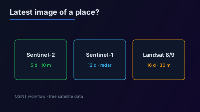
Quick Answer: The most recent free satellite image of a place usually comes from Sentinel-2 (10 m, 5-day revisit at the Equator), Sentinel-1 radar (12-day repeat per satellite, six days for two), or Landsat 8 and 9 (30 m, 16-day repeat each, offset by 8 days). NASA Worldview shows global imagery, with many products available within hours. Consumer map apps are not live: Google states that its images are not in real time. Always read the acquisition date of the image before drawing a conclusion from it.
The newest free satellite image of a place is rarely in a map app. It is in the archives of the satellites that image the whole Earth on a fixed schedule: Sentinel-2, Sentinel-1 and Landsat. Each has a known revisit, so the age of the latest image is predictable, and each records the date and time of every acquisition. This guide shows where to look, how recent each source can be, and how to confirm the date of what is on screen.
Why is the image in a map app not the latest one?
Consumer map apps show a mosaic assembled from many images taken at different times, chosen for clarity rather than recency. Google's own help page says that "images aren't in real time, so you won't see live changes" and that images are collected over time from providers and platforms.
That makes a map app the right tool for context, such as the layout of a port or the position of a building, and the wrong tool for a question about last week. If a report says something changed recently, a basemap that shows no change proves nothing: the image may simply predate the event. The first check on any image is its acquisition date.
Which free satellites have the most recent imagery?
Three free missions image the land surface repeatedly, and one NASA viewer shows global imagery within hours. Which is "most recent" for a given place depends on where each satellite is in its cycle and, for optical sensors, on cloud.
| Source | Type | Detail on the ground | How often | Sees through cloud |
|---|---|---|---|---|
| Sentinel-2 | Optical | 10 m in four bands | Revisit of 5 days at the Equator with two satellites | No |
| Sentinel-1 | Radar (C-band) | 5 m by 20 m single look in the main land mode | 12-day repeat per satellite, six days for two | Yes |
| Landsat 9 with Landsat 8 | Optical | 30 m, 15 m panchromatic | 16-day repeat each, with an 8-day offset between the two | No |
| NASA Worldview | Global imagery viewer | Varies by product | Many products within hours of acquisition | Depends on the product |
All four are free. Copernicus states that Sentinel data products are made available free of charge to all users, and the USGS states that all Landsat 9 data are available for download at no charge.
For a specific building or facility, start with Sentinel-2. For a place under cloud, or a question about the last few nights, go to Sentinel-1. For a regional view of smoke, flooding or a storm on the same day, NASA Worldview is the fastest.
Where do you actually look?
Each archive has an official browser, and each of them shows the acquisition date of the image on screen. Use the official source when the date matters, because third-party mosaics can blend several dates.
- Copernicus Browser. The official viewer for Sentinel data. Its documentation describes a "Show latest date" button, a maximum cloud coverage filter, and a compare mode for two or more dates, and notes that a free account is currently needed.
- USGS. Landsat data are distributed by the USGS Earth Resources Observation and Science (EROS) Center. Landsat adds an independent optical look at 30 m, which helps when the Sentinel-2 passes were cloudy.
- NASA Worldview. NASA describes it as a tool to browse, compare, animate and download over 1,200 visualized satellite data products, many available within hours of being acquired. Use it for same-day regional context, not for single buildings.
- Off-Nadir Delta. The Sentinel-2 viewer stacks the last 5 days of Sentinel-2 passes in natural colour on a live map with no login, and the live fire map shows NASA FIRMS detections for any day.
A comparison of these and other tools by task is in best OSINT satellite imagery tools.
How do you find the latest clear image, not just the latest image?
The latest optical image is often cloud. The useful image is the latest one in which the place itself is visible, and finding it means stepping backwards through dates rather than trusting a cloud percentage.
- Start from today and go back. List the acquisitions over the place in the last few weeks.
- Filter by cloud cover, then check by eye. A scene-level cloud percentage describes the whole scene, which is far larger than one site. A scene that is mostly cloudy can still be clear over the target, and a mostly clear scene can have one cloud exactly where it matters.
- Switch sensors if optical fails. Sentinel-1 radar images day and night regardless of the weather, so a recent radar image usually exists even after weeks of cloud.
- Use a second optical mission. Landsat 8 and 9 pass on different days from Sentinel-2, which adds more chances of a clear look.
Reading the radar fallback takes practice; SAR vs optical: when to use which explains what each shows, and Sentinel-2 cloud masking covers how cloud is flagged.
How do you confirm the date of the image you are looking at?
Read the acquisition time from the source, in UTC, and write it down with the image. Satellite archives record the sensing time of every scene. A date shown in a social media post, a screenshot or an article caption is a claim about the image, not the image's own metadata.
Three habits prevent most date errors:
- Use UTC. Archives store sensing time in UTC. An image taken at 08:40 UTC is late afternoon in East Asia and just after midnight on the west coast of North America.
- Separate acquisition from publication. The day an image appeared online is not the day it was taken.
- Beware mosaics. A seamless cloud-free picture of a large area is usually built from several dates. Ask which date covers the exact spot.
When the date decides whether an image is from before or after an event, the acquisition time is the evidence. The full before-and-after method is in how to verify a reported event with free satellite imagery.
When will the next image be taken?
The next image is predictable, because these satellites fly fixed repeating orbits. If the latest image predates the event, the question becomes when the next pass will cover the place, and the answer comes from public orbit data rather than from waiting and refreshing.
A single Sentinel-1 satellite repeats its ground track every 12 days, and Landsat 9 every 16 days with Landsat 8 offset by 8 days. Sentinel-2 is designed for a 5-day revisit at the Equator.
Satellite pass prediction works out the next access windows for a place across the free systematic satellites and taskable commercial ones, and when can a satellite next image this place? explains the method. If no free pass falls inside the deadline, that gap is the case for commercial tasking; free vs commercial satellite imagery compares the two.
What can the most recent free image not show?
The most recent free image has the resolution of its sensor, and no amount of recency changes that. A 10 m Sentinel-2 image from yesterday still cannot show a vehicle.
Recency and detail trade against each other across free sources: the products that arrive within hours are built for regional views, and the 10 m products come every few days. Sub-metre imagery of a specific place on a specific day is a commercial product. What the free image can do is show that something large changed and roughly when, which is often enough to decide whether a closer look is worth paying for. For the limits by object size, see the four types of satellite image resolution.

Remote sensing specialist with 10+ years in satellite data processing and AI. Founder of Off-Nadir Lab. Ph.D. in Informatics (Yokohama National University, 2026). Master's in Earth System Science and Technology (Kyushu University). Co-author, Remote Sensing Encyclopedia. More about the author →